Tour to Historic, Danakil Depression and Rift Valley by flight & Surface 15Days
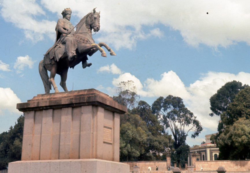
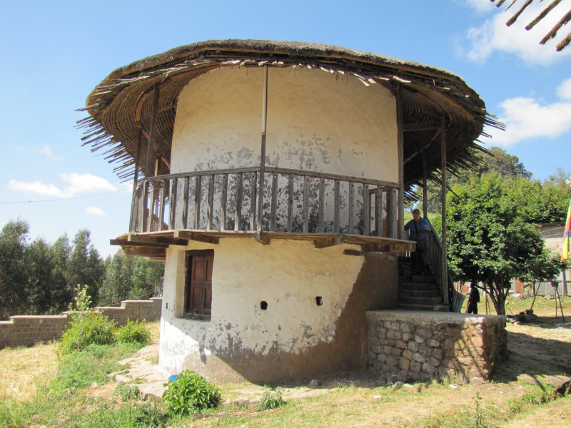
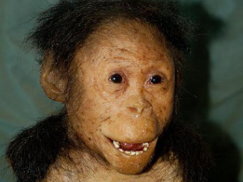
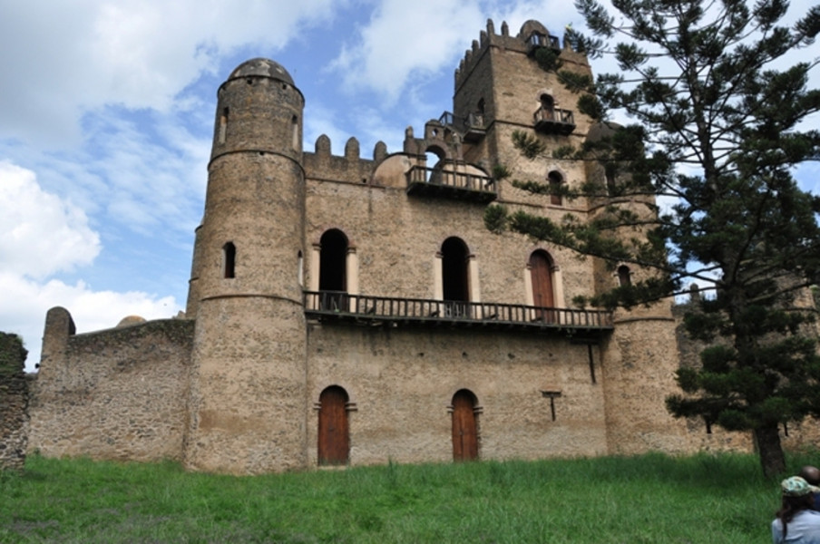
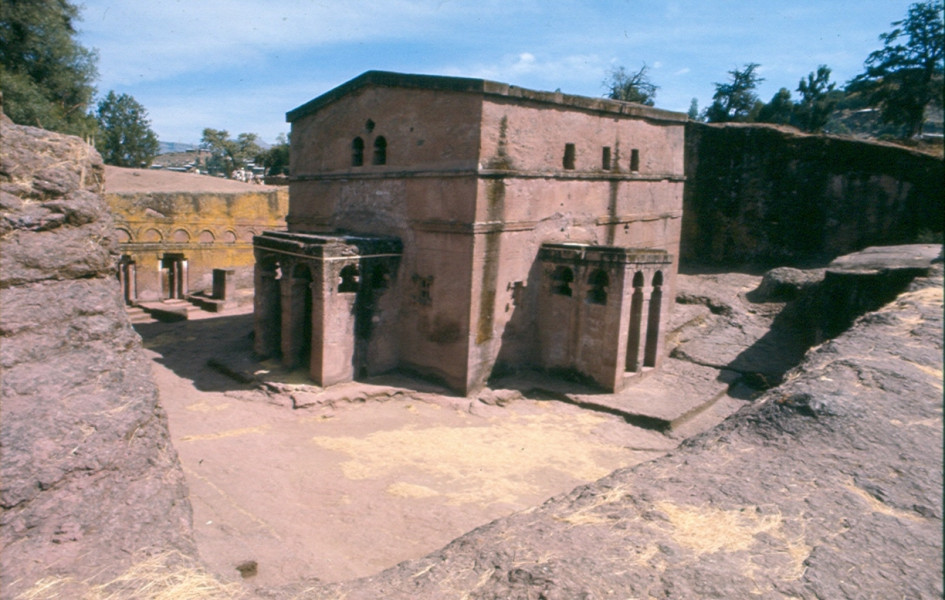
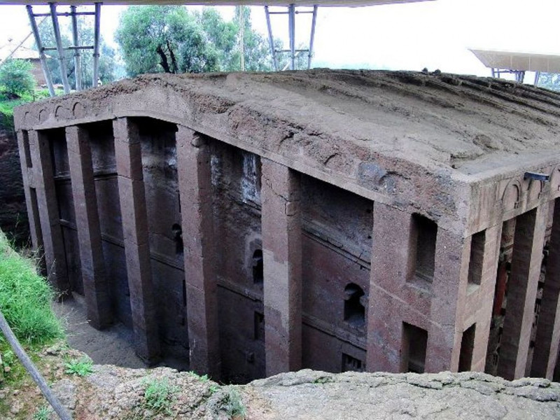
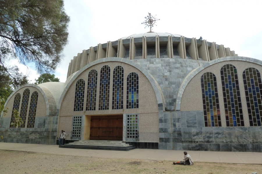
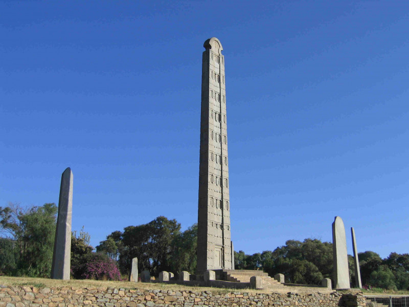
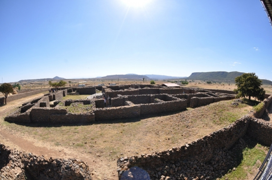
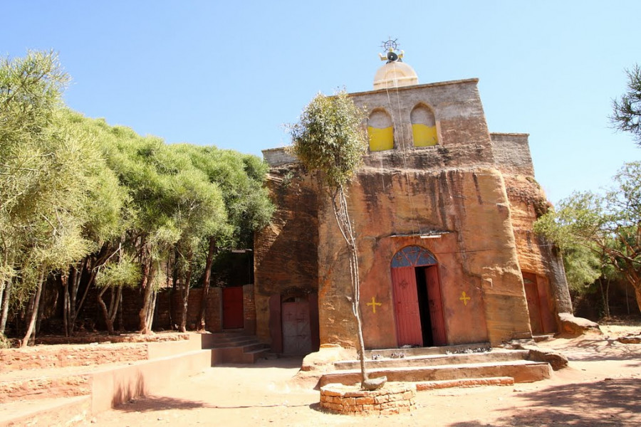
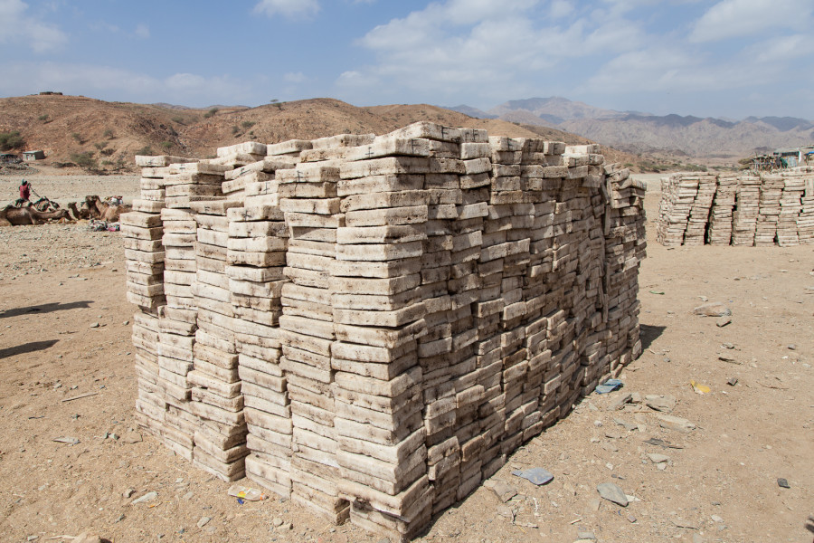
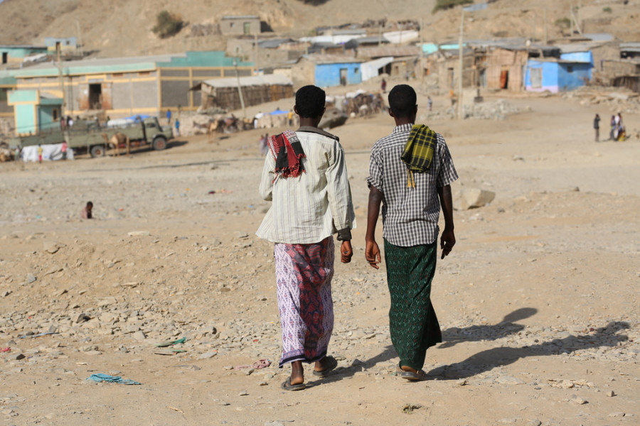
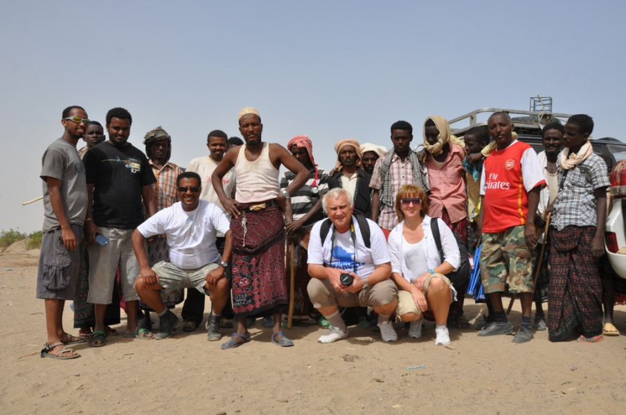
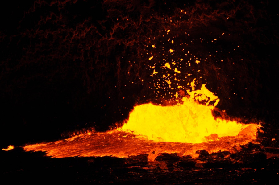
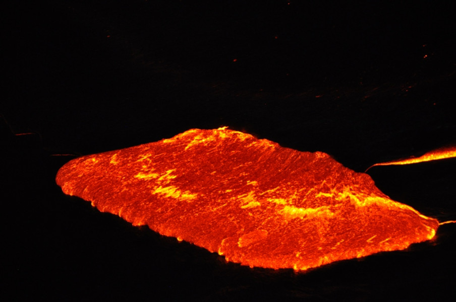
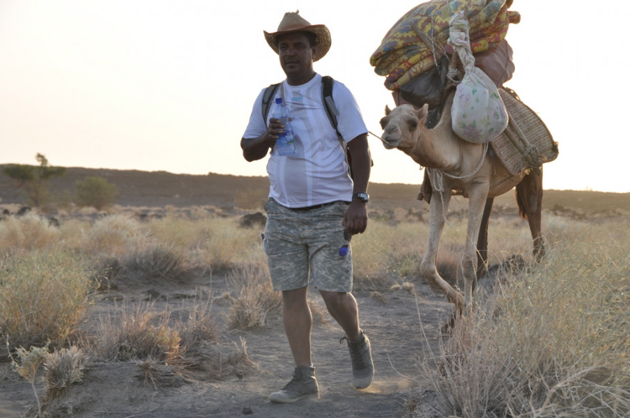
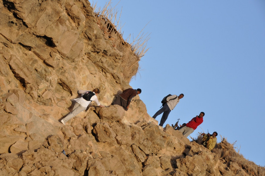
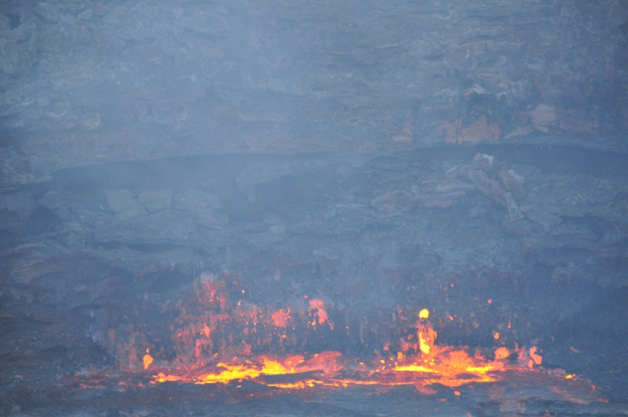
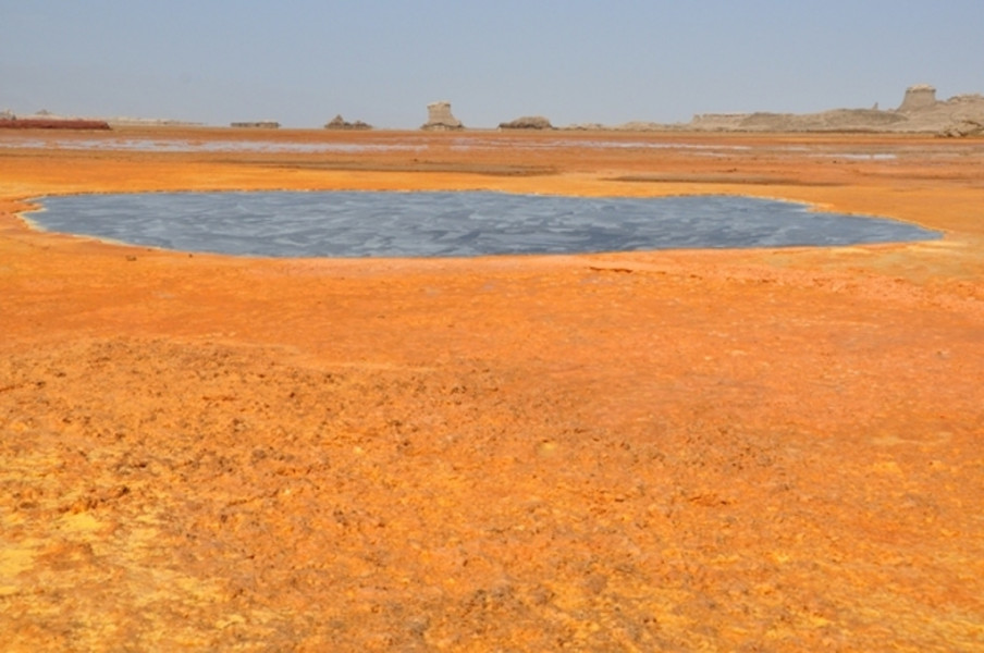
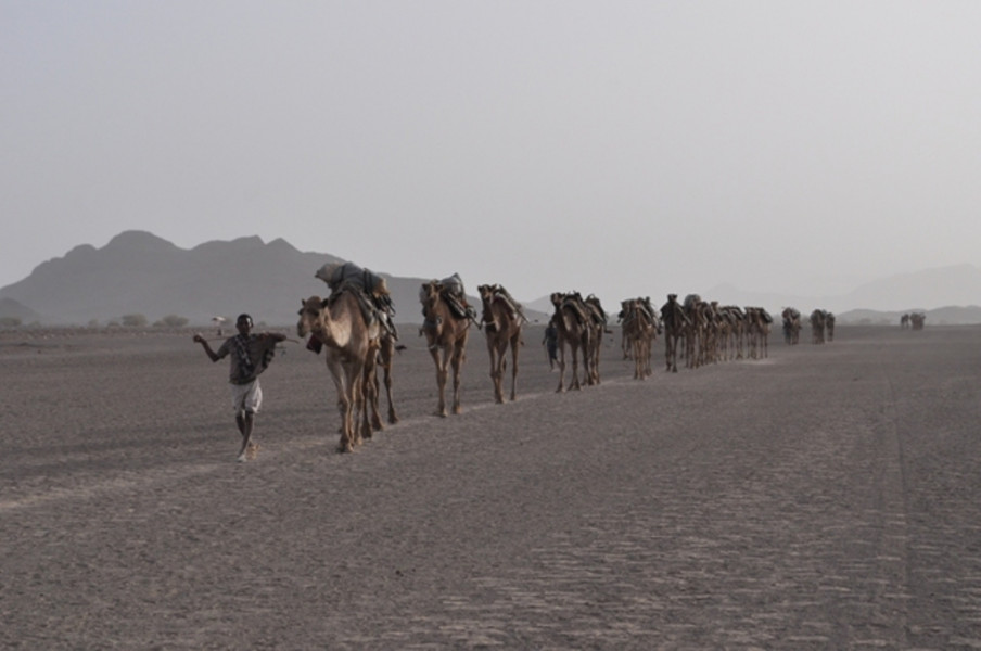
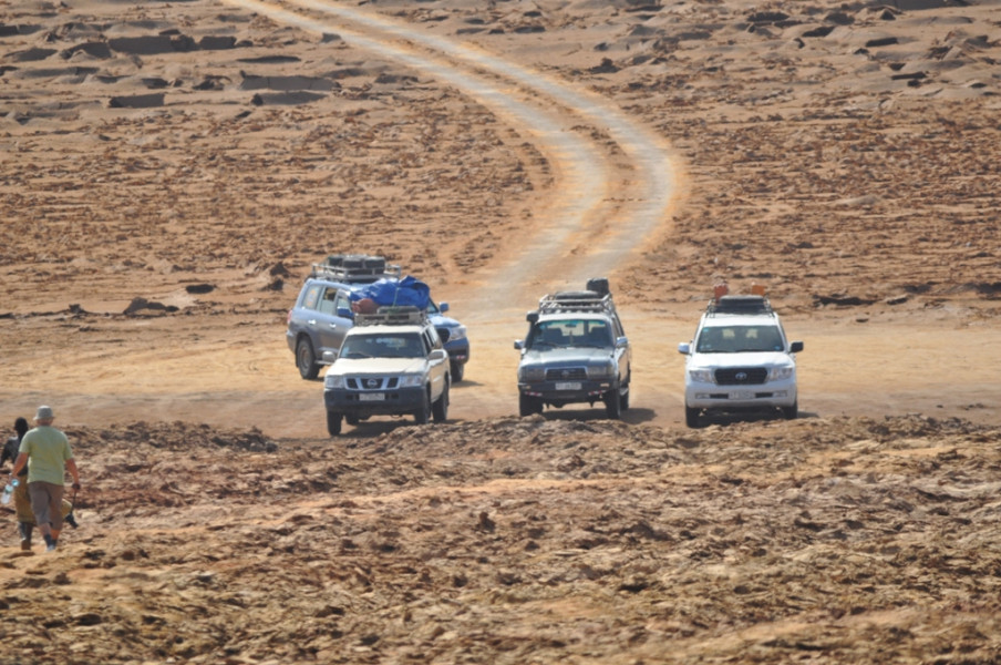
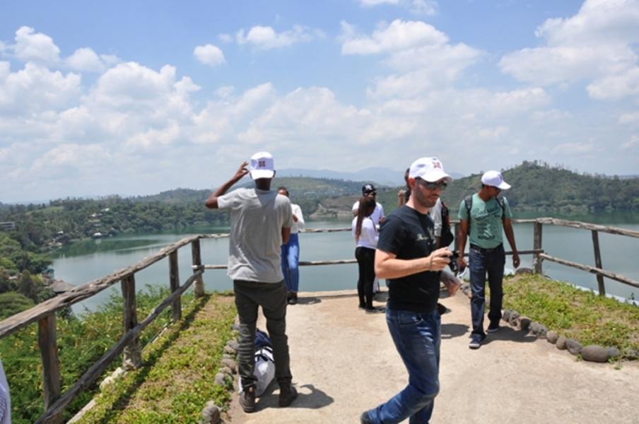
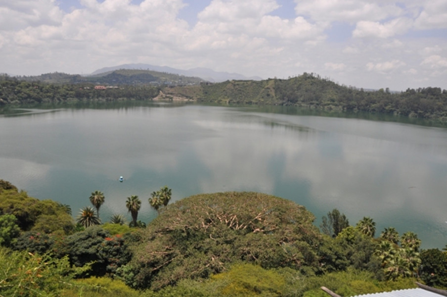
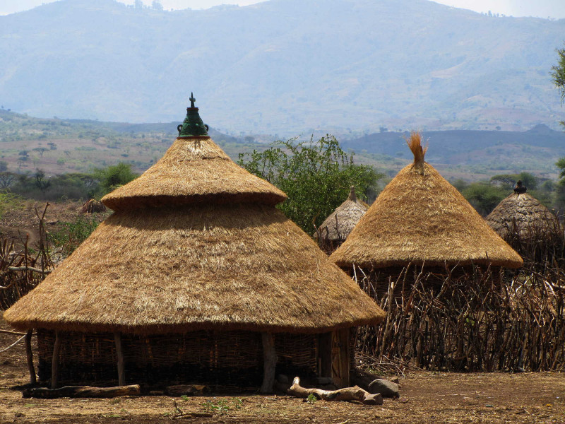
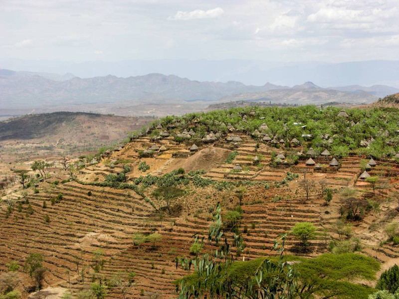
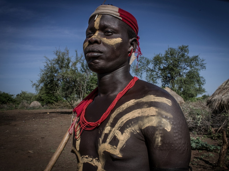
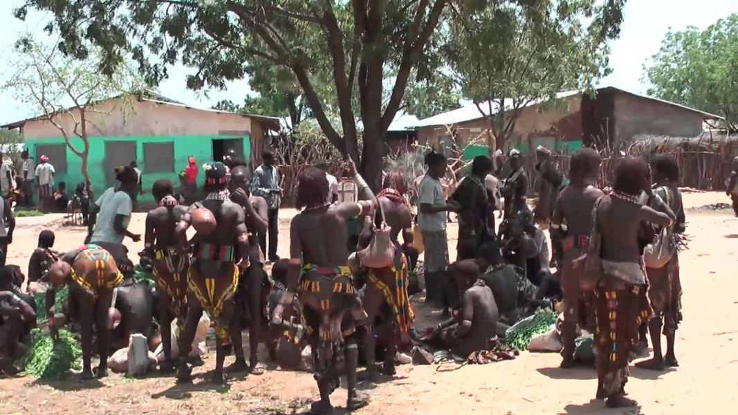
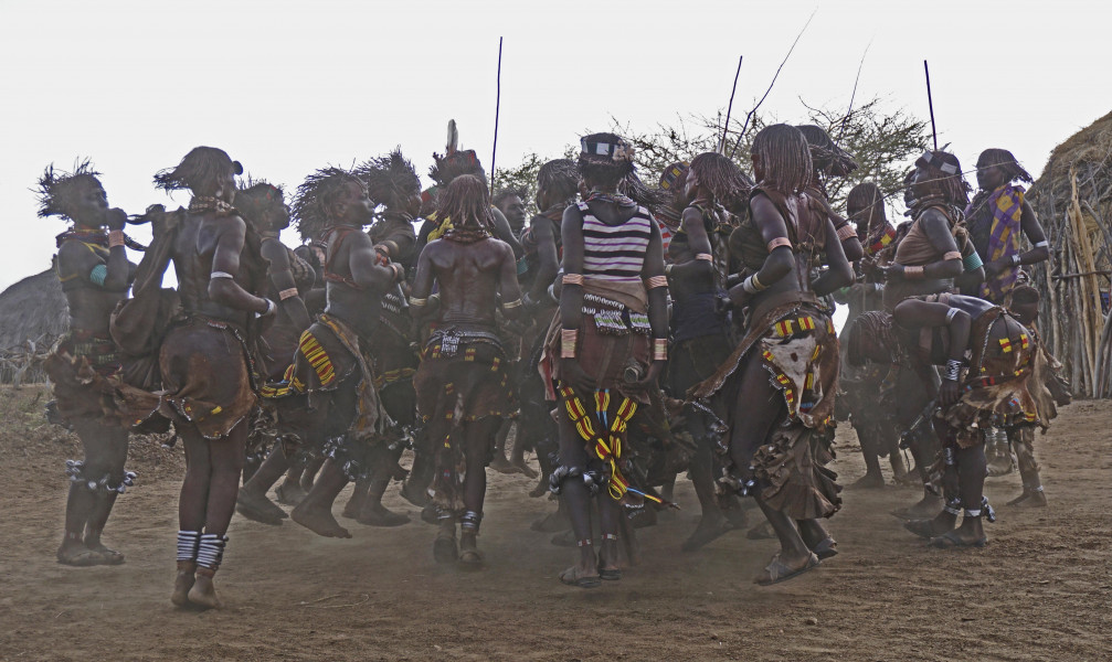
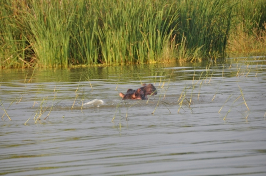
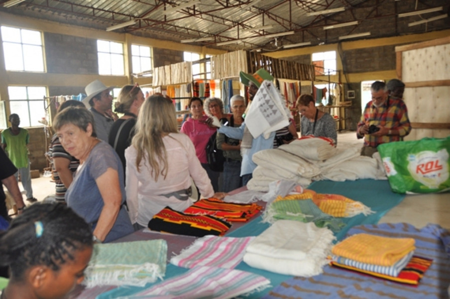
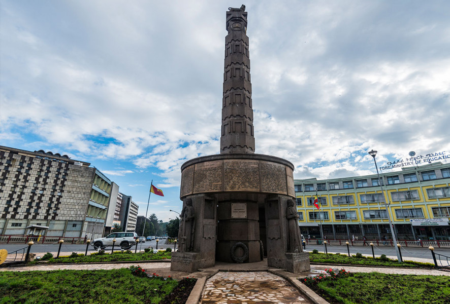
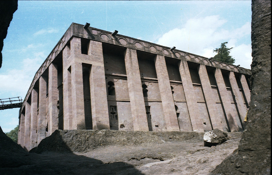
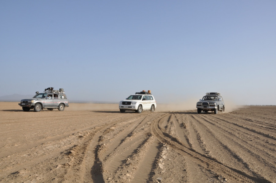
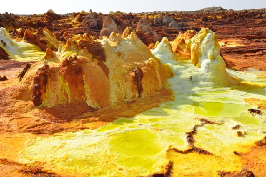
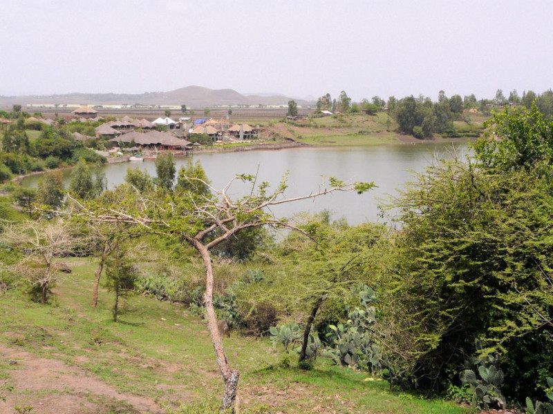
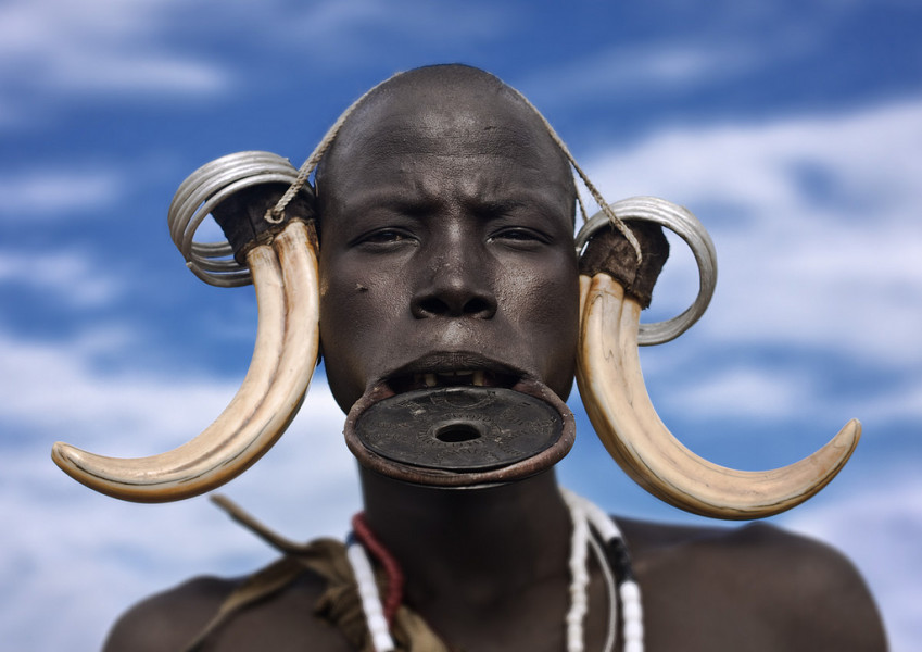
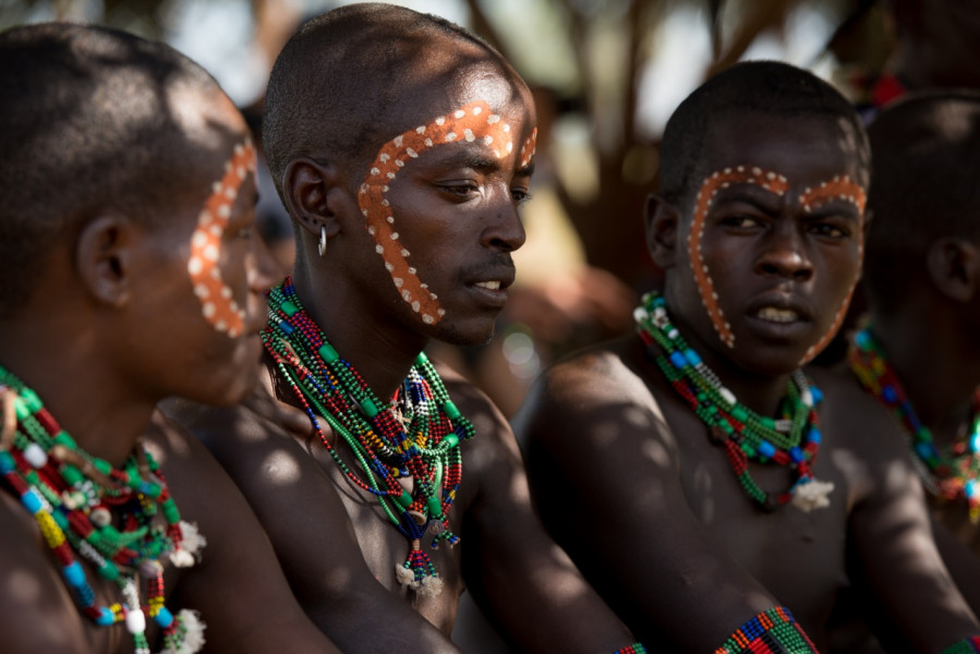
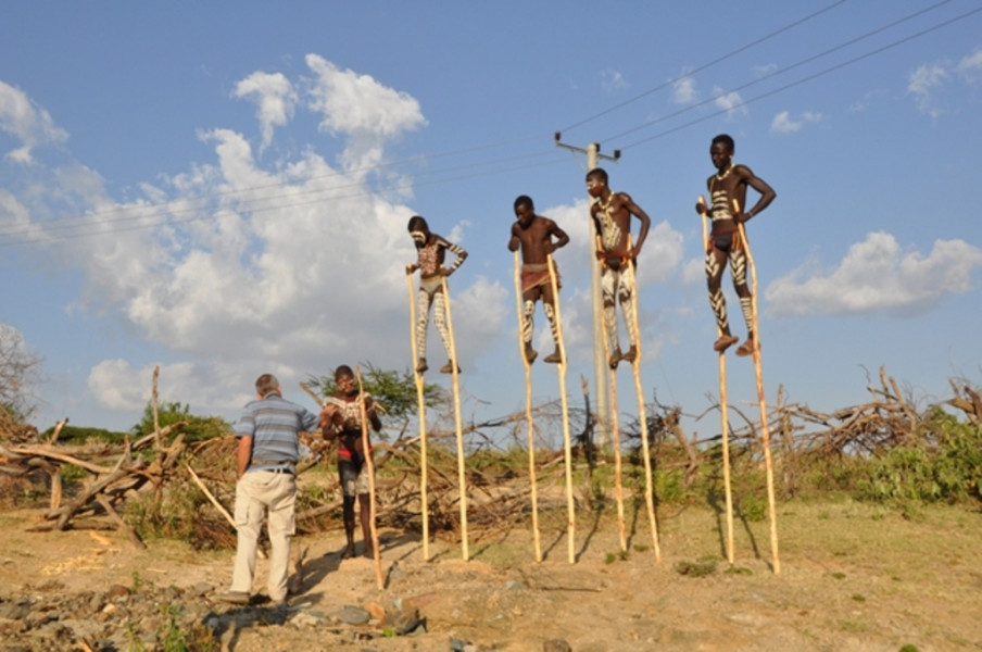
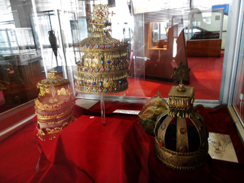
According to the written documents the history of Ethiopia remains for over 2500 years and all located in the northern part of the country. Here are the major old permanent capitals of the country chronologically. Axum is located in Tigrai Region at 1024km distant from Addis Ababa and the cradle of Ethiopian ancient civilization and hub for Christianity belief since 342 AD. It is an exotic tourist destination which offers a harmony of ancient history, antiquities, sacred places, natural endowment, convenient weather and perfect infrastructure with tourist standard hotel. Unlike many other states of the era, Axum was elaborately advanced in minting coins, masonry, pottery, metallurgy, taming animals, cultivating cereals, architecture, mathematics etc. Lalibela is the second permanent capital of the country and a medieval settlement in the Lasta area of Wollo. It is the host of eleven remarkable rock-hewn monolithic churches and believed to have been built by King Lalibela in the late 12th century. Each building is architecturally unique, and most of them are decorated with fascinating rock paintings. Gondar was founded by Emperor Fasilidas around the year 1636. During its long years as a capital, the settlement emerged as one of the largest and most popular cities in the realm. It was the great commercial center, trading with the rich lands south of the Blue Nile, as well as with Sudan to the west, and the Red Sea port of Massawa to the north east. It is also comprises several medieval castles with the contemporary design and decoration of churches. Bahir Dar is a clean and well-maintained city and endowed with Lake Tana. Lake Tana is the largest lake in Ethiopia, located in a depression of the northwest plateau, 6,000 feet (1,800 metres) above sea level. It forms the main reservoir for the Blue Nile (Abbay) River, which drains its southern extremity near Bahir Dar. The lake's surface covers 1,418 square miles (3,673 square km), with a surrounding drainage of 4,500 square miles (11,650 square km); its maximum depth is 45 feet (14 meters). The islands and peninsulas of Lake Tana are most conveniently approached by boat from Bahir Dar on the southern side of the lake, though boats can often also be obtained at Gorgora on the northern shore. The Blue falls is a waterfall on the Blue Nile in Ethiopia and its meaning is "great smoke". It is situated on the upper course of the river, about 38 km downstream from the town of Bahir Dar and Lake Tana. The falls are estimated to be between 37 and 45 meters high, consisting of four streams that originally varied from a trickle in the dry season to over 400 meters wide in the rainy season Lake Chamo is 32 kilometers long and 13 wide, with a surface area of 317 square kilometers and a maximum depth of 14 meters with a catchment of about 18757 square kilometers in size. The lake is just to the south of Lake Abaya and the city of Arba Minch, and east of the Guge Mountains. Wildlife include fish like the catfish and Nile Perch, as well as hippopotamus and Nile crocodile abundantly available Konso is an ethnolinguistic group located in the arid highlands of southwestern Ethiopia. Their sharply delimited traditional territory is surrounded by lands of Oromo peoples, to whom the Konso are culturally and linguistically related. They are a Cushitic people. Unlike most Ethiopian peoples, the Konso live in large towns, each governed by an autonomous council of elders. The social status of all males, and of some females, is defined by a generation-grading system. Although a generation grade theoretically encompass the men in an entire region, it does not actually function beyond each town’s borders and therefore does not prevent conflicts between towns. Kinship is reckoned in nine exogamous, patrilineal clans and in lineages that are headed by priests and through which property is inherited. Craftsmen form a distinct social class. Although polygene is accepted, few men can afford more than one wife. The economy of the Konso rests on an exceptionally intensive agricultural involving irrigation and terracing of mountain slopes. Corn (maize) and numerous varieties of sorgum are the staple crops, and cotton and coffee are cash crops. To protect the fields the Konso maintain their cattle in stalls and feed them by hand or supervise their grazing. They use both the milk and the meat of cattle and the meat of sheep and goats as food, and the animals’ dung is collected for fertilizer. Numerous other animals are taboo as food. The Hamer tribe belongs among the tribal people living in the south Omo valley. They are a semi- pastoralist and known in their bull jumping and Evangadi dancing ceremony. If a young man desires to get married, he must jump over back of 7-15 bulls for two rounds without falling down in each way but at the end of each way he dismounts for a while. And if he finishes successfully he will marry according to his choice and he will also joins the ranks of Maza, men group who completed a jumping ceremony. A person must be jump castrated male cattle in order to be successful in his marriage life. But before he jumps, his female relatives are striped by stick in order to show their affection to the Jumper. Above that, young girls and boys dance Evangadi at the night for two or three consecutive days with regard the bull jumping and his parents will take over in preparing a feast for the villagers. The people of Dassanech live near the Ethio-Kenya and Ethio-Sudanese border. They shared their boundaries with the Nyangatom in the northwest, the Hamer in the north and east, the republic of Sudan in the west and Lake Turkana and Kenya in the south. They are also the East Cushitic Language Family, further they are the third populous ethnic group in south omo zone, their livelihood mainly depend on livestock, cattle, goat, and sheep. And they also cultivate sorghum and maize in Omo delta, besides fishing is common. The Mursi people are Nilo-Saharan and speak their own language. They live in the lower Omo Valley of southwestern Ethiopia. Their livelihood basis on mainly in rearing cattle and move from place to place to search for a suitable land for grazing and convenient climate for growing their crops often sorghum and maize. The Omo River meanders for nearly 1000km southwest of Addis Ababa, and 100km north of Kenyan border. The number of the Mursi inhabitants estimated less than 10,000 and live with certain division of villages in the park. Some Mursi practice flood retreat cultivation, particularly in the areas where the tsetse fly prohibits cattle rearing. Honey is collected from beehives made with bark and dung. The most famous Mursi traditions include the fierce stick fighting between the men, and the lip-plate is worn by the women. It is made of clay and often quite large, the plates are inserted into slits in their lower lips. It is thought that the Mursi women wear the plates to attract husband and boost their beauty. The Dorze people are a small ethnic group in Ethiopia who speak a language in the Omotic family. Many Dorze live in villages near the cities of Chench and Arba Minch, in the Southern Nations, Nationalities, and peoples region. Weaving is a primary profession for many Dorze. They also are farmers,who prevent soil erosion, by ingenious terracing of the mountainside. Around their huts they have their own little garden with vegetabes, spices, and false banana. The Dorze people famous are for their huge huts, resembling a giant beehive. Although these huts look fragile, they can last up to 60 years. Lake Awassa is an endothecia basin in Ethiopia, located in the Rift Valley south of Addis Ababa, this lake measure 16 km long and 9km wide, with a surface area of 129 square kilometers and has a maximum depth of 10 meters with an elevation of 1,708 meters. This lake is the most studied of the Rift Valley lakes in Ethiopia. According to William Taylor, a member of the African Lakes and Rivers Research group at the University of Waterloo, Lake Awassa is, despite its lack of an outflow, “essentially a freshwater lake (conductivity is variable, but less than 1,000) indicating that it must have a subterranean outlet. Abjiata-Shall National Park is 887 sq. km wide; 482sq km of this is covered by the lakes’ water. The altitude ranges from 1500 to 2000 meters. The highest peak is Mt fike, situated between the two lakes. The lakes are terminal, but they are very different in nature. The park was created for many species of aquatic birds, particularly great white pelicans and greater and lesser flamingoes. Lake’s islands are used as breeding sites by many birds including pelicans; and lake abijata is their feeding sanctuary. Other birds in the area include white necked cormorant, African fish eagle, Egyptian geeze, various plover species and herons. Danakil Depressions It is located in the Afar region of the country which is situated in the north eastern part of the country. Geologically one of the most active spots on the Planet Earth, it is a vast expanse of deserts, lava and below sea level salt plains and lakes, active and extinct volcanoes along a south/north chain. The hottest average temperature on earth with an extremely salty lake (Lake Afrera) at 120 meters under, the sea level kept alive by many thermal springs feeding it. It is also the land of Australopithecus Afarensis (Lucy from Hadar, in Afar) which has three million years old ancestor and having all the characteristics of Homo Spines. This area is endowed with natural attraction sites majorly Erta Ale, Afrera etc. Erta Ale is located in the remote area of Afar Depression. It is a natural volcano. And a person can see the volcano lake from the volcano rim only 20m away, which be able to experience the whole staff physically. Usually, when visitors need to visit the volcano the preferable route is Mekele-Berhale-Dodum-Erta Ale, of course it is possible through Awash-Afdera-Erta Ale. Thus, Arta Ale is the most active volcano in Africa and it is commonly visited by a number of tourists from all over the world. The lava lake is remained for more than 125 years and since 1967 the eruption continues without stop. Dallol is located in the Afar region near to the Eritrean border. It is the hottest spot in the world in terms of average temperature. It is also the lowest place in Africa, reaches -116m above sea level and the temperature ranges greater than 50 degree.